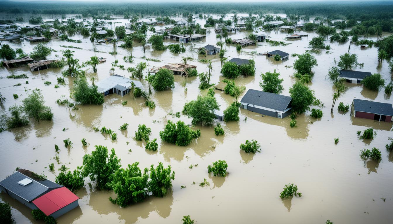


Floods are the most common and costly natural disaster in the United States, impacting millions of Americans. While flooding can occur anywhere in the country, certain regions are more prone to floods than others. Have you ever wondered which areas in the United States experience the highest frequency of floods?
In this article, we will explore where floods hit the most in the United States and provide an in-depth analysis of the prevalence and impact of flooding in these areas. By understanding the geographic distribution of flood-prone regions, we can gain valuable insights into how floods affect communities and the steps that can be taken to mitigate their impact.
Key Takeaways:
- Floods are the most common and costly natural disaster in the United States.
- Certain regions in the United States are more prone to floods than others.
- Understanding the prevalence and impact of flooding in high-risk areas is crucial for effective flood mitigation.
- Analyze flood data to identify regions with the highest frequency of floods.
- By preparing and protecting ourselves against floods, we can minimize their devastating effects.
Understanding the Prevalence of Flooding in the United States
Flooding is a common natural disaster that affects the United States, leading to significant damages and disruptions. To better understand the prevalence of flooding in the country, it is essential to define what constitutes a flood and explore different methods for tracking and analyzing flood events.
Flooding is defined as the partial or complete inundation of normally dry land involving two or more acres and two or more properties. It occurs due to heavy rain, snowmelt, hurricanes, or other factors that cause water bodies, such as rivers and lakes, to overflow onto surrounding areas.
Counting the number of flooding events in the United States can be challenging due to the large areas they can cover and the extended duration of some floods. However, several approaches are used to track and understand the prevalence of flooding.
One method involves analyzing the number of flood insurance claims made to the National Flood Insurance Program (NFIP). NFIP is a federal program that offers flood insurance to property owners in flood-prone areas. By studying flood insurance claims, experts can gain insights into the frequency and severity of flooding events.
Another method utilized by researchers and government agencies is the collection and analysis of historical data on flood occurrences, water levels, and precipitation patterns. This data can be obtained from various sources such as weather stations, river gauges, and satellite imagery. These sources provide valuable information for understanding the extent and impact of flooding in different regions of the United States.
The prevalence of flooding in the United States is a complex issue that requires a comprehensive understanding of the factors contributing to flood events and their impact on communities. By studying the definition of flooding and using various counting methods, experts are able to track, analyze, and mitigate the effects of flooding to protect lives and property.
High-Risk Flood Zones and Seasonality of Flooding
Certain areas in the United States are designated as high-risk flood zones by the Federal Emergency Management Agency (FEMA). These high-risk zones have a 1% or higher chance of experiencing a flood each year.
This section will explore these high-risk flood zones and discuss the seasonal patterns of flooding in the country. It is important to understand the geographic distribution of flood-prone areas and the timing of floods in order to effectively prepare and mitigate the impact of flooding.
Most flooding events in the United States occur between early April and September, which coincides with the hurricane and tropical storm season. During this time, the combination of heavy rainfall and storm surges can lead to widespread flooding in coastal areas and low-lying regions.
By identifying high-risk flood zones and understanding the seasonality of flooding, individuals and communities can take proactive measures to safeguard their properties and reduce the risk of damage. This may include investing in flood insurance, implementing flood-resistant construction techniques, and developing emergency response plans.
Furthermore, government agencies can utilize this information to prioritize infrastructure improvements and allocate resources for flood mitigation projects in high-risk areas. By working together and utilizing data-driven approaches, we can better protect ourselves and minimize the devastating effects of flooding in the United States.
The Financial Impact of Floods on the NFIP
Floods have a significant financial impact on individuals, businesses, and the National Flood Insurance Program (NFIP). The NFIP, established in 1968, manages flood insurance for communities at risk of flooding.
When floods occur, they can cause extensive damage to homes and infrastructure, resulting in substantial costs for repairs and rebuilding. The financial burden falls on both individuals and businesses affected by the floods, as well as the NFIP, which bears the responsibility of paying out insurance claims.
Throughout history, there have been numerous costly flood events that have had a severe financial impact on the NFIP. These events, often associated with hurricanes and heavy rainfall, have led to a substantial number of insurance claims being filed. The NFIP has paid billions of dollars in insurance claims to policyholders affected by these floods, highlighting the magnitude of the financial consequences.
One example of a flood event with a significant financial impact on the NFIP is the devastating flooding caused by Hurricane Katrina in 2005. This flood event resulted in over $16 billion in insurance claims paid by the NFIP, making it one of the costliest flood events in history.
The financial impact of floods on the NFIP is not limited to past events. As climate change continues to alter weather patterns and sea levels rise, the risk of flooding is expected to increase. Coastal development further exacerbates this risk. These factors have the potential to put additional strain on the NFIP in the future, as more communities may become at risk of flooding and require insurance coverage.
In conclusion, floods have a profound financial impact on individuals, businesses, and the NFIP. The NFIP plays a crucial role in managing flood insurance and providing financial assistance to communities affected by floods. Understanding the financial consequences of floods is essential for effective planning, mitigation, and response efforts to reduce the impact on individuals and communities.
Geographic Disparities in Flood Insurance Claims
Flood insurance claims in the United States are not evenly distributed across states and counties. While floods can impact any area, certain regions experience a higher frequency of flood claims than others. Analyzing these geographic disparities provides valuable insights into the areas most affected by floods and helps in understanding the distribution of flood impact.
To get a clearer picture of these disparities, let’s take a look at the states and counties with the highest number of flood insurance claims. These regions have consistently shown a higher incidence of flooding, resulting in more claims being filed. By examining the specific locations that experience a greater number of claims, we can identify patterns and understand the underlying factors contributing to higher flood risk.
The National Flood Insurance Program (NFIP) plays a crucial role in administering flood insurance policies and assessing risk levels for flood-prone areas. Through its data collection and analysis, the NFIP identifies regions that are more susceptible to flooding. This information helps homeowners, businesses, and local authorities make informed decisions regarding flood insurance coverage and mitigation strategies.
Understanding the geographic disparities in flood insurance claims is essential for developing targeted strategies to address the specific needs of high-risk areas. By focusing on these areas, policies and measures can be implemented to minimize the impact of floods and ensure the resilience and preparedness of communities against future flooding events.
Conclusion
Floods are a significant and costly natural disaster in the United States. With their ability to occur anywhere in the country, it is essential to recognize the regions that are more prone to flooding. Understanding the prevalence and impact of flooding is crucial for individuals, communities, and government agencies responsible for flood mitigation and disaster response. By analyzing flood data and identifying high-risk areas, we can better prepare and protect ourselves against the devastating effects of floods.
In the United States, floods have the potential to cause immense damage to infrastructure, homes, and lives. By studying flood patterns and gathering data, experts can prioritize resources and develop effective strategies for flood management. This includes implementing protective measures such as levees, flood walls, and floodplain regulations to minimize the impact of floods.
Furthermore, raising awareness among communities about flood risks and educating them on precautionary measures can help save lives and reduce property damage. By understanding the specific risks in their area, individuals can take steps such as purchasing flood insurance and creating emergency plans to safeguard their well-being.
In conclusion, floods continue to pose a significant threat in the United States, necessitating constant vigilance and proactive measures. By acknowledging the prevalence of flooding and using data-driven approaches, we can work towards minimizing the impact and increasing resilience in the face of this natural disaster.